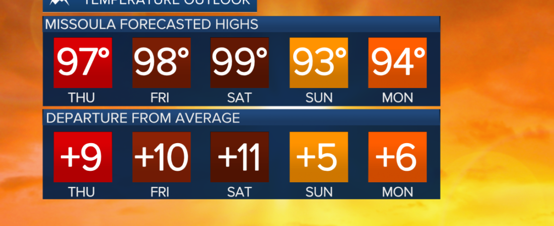
MISSOULA — Temperatures across western Montana continue to climb this week. We are expected to get in the mid to upper 90s on Thursday, Friday, and Saturday across the region, potentially making this the hottest stretch of the summer so far.The risk for flash flooding persists south and east of the Bitterroot Valley tonight, as heavy, slow-moving thunderstorms dump rain around 1-2 inches per hour over the higher terrain.
There is a low chance of thunderstorms developing and moving through western Montana tomorrow, with the highest likelihood coming in the late afternoon to early evening.After Thursday, rain will be hard to come by through the rest of July. We are expecting very dry air through the weekend. High temperatures well into the 90s with wind gusts around 20 to 30 MPH will create critical fire weather conditions.A stornger west to southwest flow aloft will also bring more opportunities for thicker smoke from fires in Washington and Oregon over the weekend.——————————————————————————————————————————MONTANA WEATHER ALERTS:
MTN
MTN
MTN
——————————————————————————————————————————
MTN
MTN
MTN