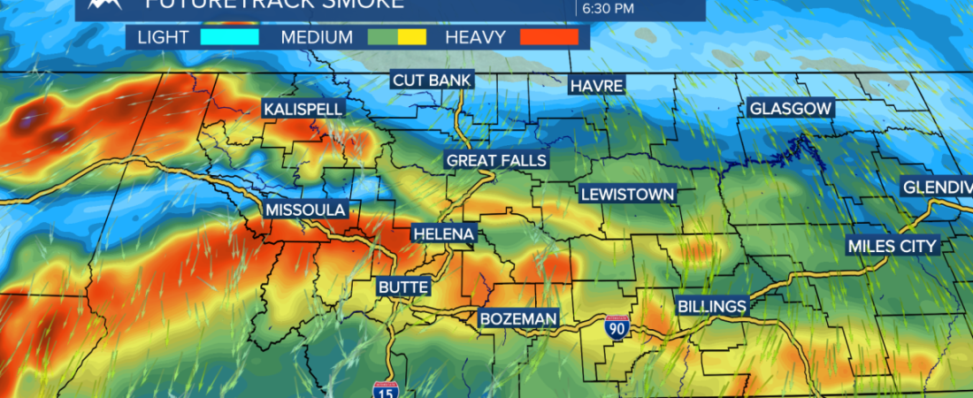
MISSOULA — Wildfire smoke from Washington, Oregon, and Idaho have blown into western Montana with westerly flow aloft Sunday and Monday. Air quality has been “moderate” for most of the day, with a noticeable haze around most communities. Smoke conditions will begin to improve slightly across the area on Tuesday with a weak east wind developing. There is still opportunity the rest of the week with southwest flow coming back into the picture Wednesday and Thursday to receive more smoke.
Temperatures stayed in the 70s and low 80s today due to cloud cover and smoke. Out high temperatures will once again be warming back into the 90s this week once the area of clouds begins to clear out on Tuesday. I am expecting Missoula in the mid to upper 90s Thursday through Saturday.
Dry air near the surface is preventing any rain falling today, but air with more available moisture will be pumped into the area throughout the week. We will be looking at thunderstorms returning to southwest Montana on Wednesday, with the potential for more widespread activity on Thursday. We will be withering the potential for severe weather and localized flash flooding on Thursday as well.Fire danger comes u towards the end of the week and the weekend with hot temperatures, low humidity, and breezy conditions.——————————————————————————————————————————MONTANA WEATHER ALERTS:
MTN
——————————————————————————————————————————
MTN
MTN
MTN